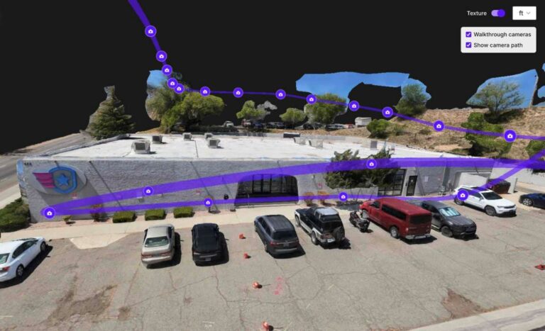
Drone mapping software has steadily improved at turning aerial imagery into detailed 3D models, but many users still struggle with the next step: understanding what they are looking at once the model is built. Identifying objects, annotating features, or simply orienting oneself within a complex point cloud can be time‑consuming and frustrating, especially for creators who need to deliver clear, actionable insights to clients or teammates.
SkyeBrowse has addressed this pain point with a major platform update released on June 1, 2026. The update introduces a feature that makes every individual photo embedded in a drone‑generated 3D model clickable. When a creator selects a point in the model, the corresponding source image pops up, allowing immediate visual verification of textures, colors, or details without leaving the 3D environment.
Beyond clickable photos, the update also boosts overall model quality and enhances the software’s AI‑generated floor plan capabilities. The improved algorithms produce cleaner surfaces and more accurate geometry, while the AI floor plan tool now extracts layout information with greater fidelity, reducing the need for manual tracing.
For content creators, these changes translate into a smoother workflow. Clickable images cut down the time spent hunting for the right reference shot, enabling faster annotations, measurements, and storytelling directly within the model. Better model reliability and richer floor plans mean deliverables look more professional and require fewer revisions, which can help creators win repeat business and meet tight deadlines.
Overall, SkyeBrowse’s June 2026 update tackles the post‑processing bottleneck that many drone mappers face. By linking photos directly to the 3D scene and sharpening both model fidelity and AI‑driven layout extraction, the platform gives creators a more intuitive and efficient way to explore, explain, and export their aerial data.
Join the conversation
Load Facebook comments to read and reply using your Facebook account.